


Mapas del Archivo General de la Nación
Identifier
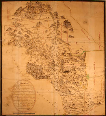
BD00026-Centro de Informacion grafica cig.0098
Creation Date
11-1-1792
Description
Map of the Provincia de Nueva Vizcaya, Chihuahua
Physical Description
.JPG, 1 Map, 88.5 x 95 cm
Preview
Recommended Citation
Mapas del Archivo General de la Nación, UTRGV Digital Library, The University of Texas – Rio Grande Valley. Accessed via https://scholarworks.utrgv.edu/archgeneralnacion/
Keywords
Maps, Mexico--Nueva Vizcaya (New Spain), 1790-1799
