


Mapas del Archivo General de la Nación
Identifier
BD00026-Catalogo de ilustraciones #5215
Creation Date
1-1-1851
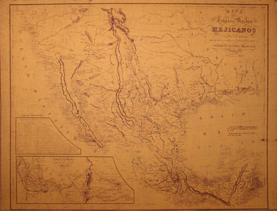
Description
Map of Mexican Republic before the Treaty of Guadalupe (with details of the road from Veracruz to Mexico) / Map of the United States of Mexico
Congreso General Mejicano. Scale of 200 miles.
Physical Description
.JPG, 1 Map, Heliografica. 76 x 56.5 cm
Preview
Recommended Citation
Mapas del Archivo General de la Nación, UTRGV Digital Library, The University of Texas – Rio Grande Valley. Accessed via https://scholarworks.utrgv.edu/archgeneralnacion/
Keywords
Maps, Mexico, Texas, United States--Southwestern States, 1850-1859
