


Fort Brown Maps
Creation Date
3-1869
Description
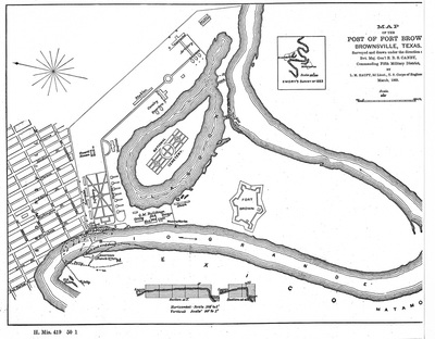
Black and white sketch reproduction. "Map of the Post of Fort Brown. Brownsville, Texas. Surveyed and drawn under the direction of Bvt. Maj. Gen'l E. B. S. Canby, Commanding Fifth Military District. By L. M. Haupt, 2d Lieutenant., U.S. Corps of Engineers. March, 1869. H. Mis. 419 50 1"
Physical Description
.JPG, 1 Map, BW
Preview
Recommended Citation
Fort Brown Maps, UTRGV Digital Library, The University of Texas – Rio Grande Valley. Accessed via https://scholarworks.utrgv.edu/fbmaps/
Keywords
1860-1869, Texas--Fort Brown, Mexico--Matamoros (Tamaulipas), Texas--Brownsville, Military bases -- Texas -- Brownsville, Fortification -- Texas -- Brownsville -- History
