


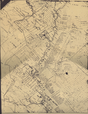
Lower Rio Grande Valley Maps
Description
[Washington, D.C.] : U.S. Coast Survey
Physical Description
.JPG, 1 Map on 4 Sheets; 46 x 61 cm. each.
Preview
Recommended Citation
Porciones - Page 02, Starr and Zapata Counties (Tex.). UTRGV Digital Library, The University of Texas – Rio Grande Valley. Accessed via https://scholarworks.utrgv.edu/maps
Keywords
Land grants, Maps, Porciones, Texas--Zapata County, Texas--Starr County, Texas--Lower Rio Grande Valley
