


Lower Rio Grande Valley Maps
Identifier
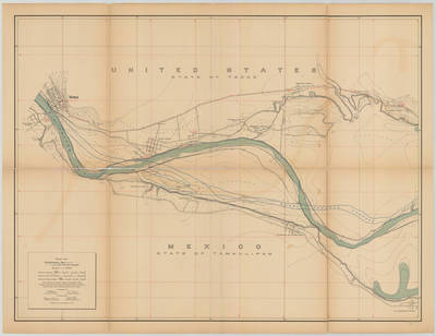
Banco map 89525
Creation Date
10-24-1912
Description
[Banco map 89525] Ranches included: San Pedro Ranch, Morteritos Ranch, Rancho Nuevo, Refugio Ranch, Escobares Adentro Ranch, San Jose Ranch, Escobar Ranch, Moreno Ranch, Garceno Ranch, and El Guardado Ranch.
Physical Description
.JPG, 1 Map ; Scale 1 in 10,000
Preview
Recommended Citation
Topographical Map of the Rio Grande From Roma To The Gulf Of Mexico Sheet No. 01, Banco map 89524. (1912). Proceedings of the International Boundary Commission, United States and Mexico, American Section. UTRGV Digital Library, The University of Texas – Rio Grande Valley. Accessed via https://scholarworks.utrgv.edu/maps
Keywords
Bancos, Boundaries, International Boundary Commission, Maps, Texas--Lower Rio Grande Valley, 1910-1919
