


Lower Rio Grande Valley Maps
Identifier
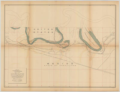
Banco map 89531
Creation Date
11-16-1912
Description
[Banco map 89531] Ranches included: Belavares Ranch [Now Valadeces], Laja Ranch, Potrero Ranch, Chicharra Ranch, Posta Ranch, Potrero Ranch, Villarreales Ranch, and Elizondo Ranch.
Physical Description
.JPG, 1 Map ; Scale 1 in 10,000
Preview
Recommended Citation
Topographical Map of the Rio Grande From Roma To The Gulf Of Mexico Sheet No. 07. (1912). Proceedings of the International Boundary Commission, United States and Mexico, American Section. UTRGV Digital Library, The University of Texas – Rio Grande Valley. Accessed via https://scholarworks.utrgv.edu/maps
Keywords
Bancos, Boundaries, International Boundary Commission, Maps, Texas--Lower Rio Grande Valley, 1910-1919
