


Lower Rio Grande Valley Maps
Identifier
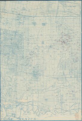
OilReportsWellLogsHidalgoCounty, ND
Description
Depicts oil and gas wells located in the mid lower Rio Grande Valley. From Donna, to San Carlos, to east of La Villa to Relampago, Texas. Rio Rico in Mexico is also included.
Physical Description
.JPG, 1 Page, BW, Scale 1" = 3000'
Preview
Recommended Citation
Beard, Joseph Radford. (n.d.). Oil Reports and Well Logs, Hidalgo County, Texas. Maps, UTRGV Digital Library, The University of Texas – Rio Grande Valley. Accessed via https://scholarworks.utrgv.edu/maps
Keywords
Maps, Texas--Lower Rio Grande Valley, Oil and gas leases, Texas--Relampago, Texas--Mercedes, San Benito and Rio Grande Valley Railway, Spiderweb, Texas--Progresso, Texas--Heidelberg, Texas--Valencia, Texas--Lacy, Texas--La Blanca, Texas--San Carlos, Texas--Donna, Texas--Santa Rita, Texas--Weslaco, Mexico--Rio Rico (Tamaulipas), 1940-1949, 1950-1959
