


Mapas del Archivo General de la Nación
Identifier
BD00026-Catalogo de ilustraciones #5140
Creation Date
1-1-1848
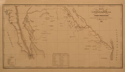
Description
Map includes legend of symbols and distances. Scale of 26 1/2 leagues.
Border of Mexico with the United States (location of new military colonies) / Map of the Border of the Mexican Republic with the United States of the North in which the situation to be given to the new Military Colonies is expressed.
Physical Description
.JPG, 1 Map, 48.5 x 28.5 cm
Preview
Recommended Citation
Mapas del Archivo General de la Nación, UTRGV Digital Library, The University of Texas – Rio Grande Valley. Accessed via https://scholarworks.utrgv.edu/archgeneralnacion/
Keywords
Maps, Mexico, Texas, 1840-1849
