



Lower Rio Grande Valley Maps
Identifier
Facts001
Creation Date
1940
Description
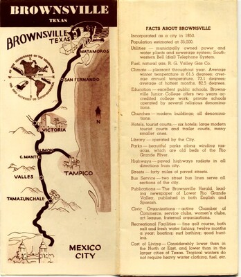
A vintage promotional tourist brochure featuring a highway strip map and a detailed municipal facts directory for Brownsville, Texas. The left-hand map illustrates a bold transport route winding south from the United States border through Mexican cities. The map includes graphic icons of border bridges, regional topography, and a compass rose. The right-hand column presents a comprehensive statistical summary detailing local infrastructure, climate statistics, educational institutions, utility grids, and mid-20th-century recreational amenities designed to attract travelers and commercial investors.
Physical Description
.JPG, 1 Page, BW
Preview
Recommended Citation
"Map of Brownville, Texas [Brochure]" (1940). Lower Rio Grande Valley Maps. 106.
https://scholarworks.utrgv.edu/maps/106
Keywords
Maps, Texas--Brownsville, Texas--Lower Rio Grande Valley, 1940s, 1940-1945
