



Lower Rio Grande Valley Maps
Identifier
Facts002
Creation Date
1940
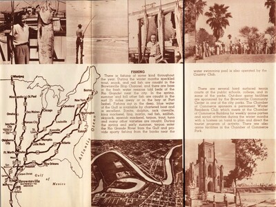
Description
A vintage tourist brochure featuring a regional route map alongside photographs and local recreation guides for Brownsville, Texas. The lower-left map illustrates a network of major United States highways stretching from midwestern and eastern cities down to their confluence at the southern border terminus, labeled "Brownsville Gateway to Mexico." The surrounding layout includes monochromatic, sepia-toned photographs depicting deep-sea sport fishing trophy catches, a palm tree lined road, and local historic architecture, flanked by detailed descriptive text sections tracking seasonal saltwater fishing zones and community recreation programs.
Physical Description
.JPG, 1 Page, BW
Preview
Recommended Citation
"Map of Brownsville Gateway to Mexico [Brochure]" (1940). Lower Rio Grande Valley Maps. 105.
https://scholarworks.utrgv.edu/maps/105
Keywords
Maps, Texas--Brownsville, Texas--Lower Rio Grande Valley, Commercial Maps, Fishing, Marine Resource, 1940s, 1940-1945
