



Lower Rio Grande Valley Maps
Identifier
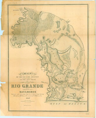
MAPA DEL PAIS AL NORTE DEL RIO BRAVO,18472
Creation Date
1847
Description
A historical military reconnaissance map detailing the coastal delta topography adjacent to the left bank of the Rio Grande extending down to the Gulf of Mexico in 1847. The map illustrates the winding paths of the river loops, regional marshlands, salt lagoons, and early transit trails. Prominent military markers trace historical strategic routes from the Mexican-American War, explicitly plotting labeled geographical landmarks such as Point Isabel, Fort Brown, the Palo Alto battlefield site, the Resaca de la Palma battlefield corridor, and the coastal beach flats of Boca Chica.
Physical Description
.JPG, 1 Page, BW
Preview
Recommended Citation
Abert, J. J.; Webster, J. D.; and McClammy, I. R., "Map of the Country Adjacent to the Left Bank of the Rio Grande below Matamoros" (1847). Lower Rio Grande Valley Maps. 109.
https://scholarworks.utrgv.edu/maps/109
Keywords
Maps, Texas--Brownsville, Texas--Lower Rio Grande Valley, Mexico--Matamoros, Reconnaissance Maps, Coastal Geography, 1847
