



Lower Rio Grande Valley Maps
Identifier
IBC_1910
Creation Date
1910
Description
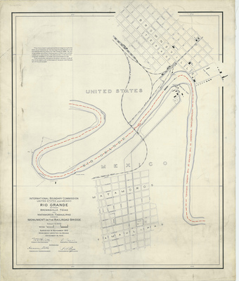
An international boundary map documenting the precise border delineation between the United States and Mexico along a loop of the Rio Grande. The map plots the grid system of downtown Brownsville, Texas, on the upper right and the street grid of Matamoros, Tamaulipas, on the lower section, split by the path of the river channel. The map focuses on the path of a railroad bridge traversing the water with a marker point defining the international boundary line in the center of the normal channel.
Physical Description
.JPG, 1 Page, Color
Preview
Recommended Citation
Follet, W. W.; Mills, Anson; Puga, F. B.; and Zayas, E., "Map of Rio Grande between Matamoros, Tamaulipas showing monument on the Railroad Bridge" (1910). Lower Rio Grande Valley Maps. 112.
https://scholarworks.utrgv.edu/maps/112
Keywords
Maps, Texas--Brownsville, Texas--Lower Rio Grande Valley, Mexico--Matamoros, Treaties, Railroad Bridges, International Boundaries, 1910-1919
