


Lower Rio Grande Valley Maps
Identifier
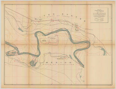
Banco map 89534
Creation Date
11-16-1912
Description
[Banco map 89534] Towns include: Reynosa Viejo, Tamaulipas; Penitas, Closner, Texas. Ranches include: Prietas Ranch, Carrizal Ranch, Salsipuedes Ranch, Porvenir Ranch, Tabasco Ranch, San Pedro De Buena Vista Ranch, Monterey Ranch, Santa Isabel Ranch, Yesca Ranch, San Pedro Ranch, Estero Ranch.
Physical Description
.JPG, 1 Map ; Scale 1 in 10,000
Preview
Recommended Citation
Topographical Map of the Rio Grande From Roma To The Gulf Of Mexico Sheet No. 10. (1912). Proceedings of the International Boundary Commission, United States and Mexico, American Section. UTRGV Digital Library, The University of Texas – Rio Grande Valley. Accessed via https://scholarworks.utrgv.edu/maps
Keywords
Bancos, Boundaries, International Boundary Commission, Maps, Texas--Lower Rio Grande Valley, 1910-1919, Texas--Penitas
