


Lower Rio Grande Valley Maps
Identifier
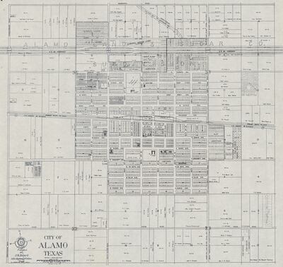
CityAlamoTexas, 1951-03-21
Creation Date
12-18-1976
Description
Map of City of Alamo, Texas depicting street level detail. Drafted by Rafael de la Garza, 1951, revised 1976.
Physical Description
.JPG, 1 Page, BW, 74 x 62 cm, Scale 1" = 300'
Preview
Recommended Citation
Beard, Joseph Radford. (1976-12-18). City of Alamo, Texas. . Maps, UTRGV Digital Library, The University of Texas – Rio Grande Valley. Accessed via https://scholarworks.utrgv.edu/maps
Keywords
1950-1959, 1970-1979, Texas--Alamo, Streets, Buildings, Properties, Alamo Land and Sugar Co. Subdivision, Land subdivision
