


Lower Rio Grande Valley Maps
Identifier
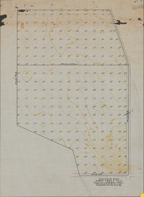
CountourMapFarmTract2271, 1925-08-06
Creation Date
8-6-1925
Description
Depicts contours in the ground of the vicinity.
Physical Description
.JPG, 1 Page, Color, Scale 1" = 100'
Preview
Recommended Citation
American Rio Grande Land and Irrigation Company (ARGLIC). (1925-08-06). Contour Map: Farm Tract 2271 [Mercedes, Texas]Maps, UTRGV Digital Library, The University of Texas – Rio Grande Valley. Accessed via https://scholarworks.utrgv.edu/maps
Keywords
Maps, Texas--Mercedes, Land subdivision, Soils, Agriculture
