


Lower Rio Grande Valley Maps
Identifier
MapaRioGrande, ND
Creation Date
1873
Description
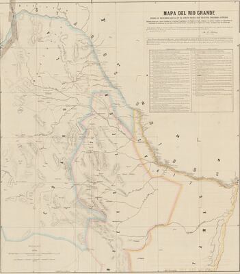
[Map of the Rio Grande from its mouth in the gulf to San Vicente, Presidio Antiguo.] Includes Coahuila, Nuevo Leon, and part of Tamaulipas as well as Mexican and American ranches along the Rio Grande, towns, villages, rivers, mountains, roads, forts, lakes, and landmarks.
Physical Description
.JPG, 1 Page, BW, Scale 1 = 800,000
Preview
Recommended Citation
Mexico. Comisión Pesquisidora De La Frontera Del Norte. (1873). Mapa del Río Grande desde su desembocadura en el golfo hasta San Vicente, Presidio Antíguo. Maps, UTRGV Digital Library, The University of Texas – Rio Grande Valley. Accessed via https://scholarworks.utrgv.edu/maps
Keywords
Mexico--Coahuila (State), Mexico--Nuevo León (State), Mexico--Tamaulipas (State), Maps, 1870-1879
