


Lower Rio Grande Valley Maps
Identifier
ELIBR-0062, Natural history, geology-maps
Creation Date
2025
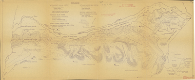
Description
Map includes the following systems: Mt. Pleasant Fluvial, Rockdale Delta, Pendleton Bay-Lagoon, San Marcos Strandplain-Bay, Cotulla Barrier Bar, Indio Bay-Lagoon, South Texas Shelf
Physical Description
JPG, 300 dpi, mimeograph, 35 x 14.5"
Preview
Recommended Citation
[Map] Texas Geological Systems, n.d. Reference Files, ELIBR-0062. The University of Texas Rio Grande Valley, Special Collections and Archives, Edinburg Campus. https://scholarworks.utrgv.edu/maps/89/
Keywords
Map, Geology, Southeast Texas, 1950-1959, 1960-1969, 1970-1979
