


Lower Rio Grande Valley Maps
Identifier
1869FortBrown_Army, 1869-03
Creation Date
3-1869
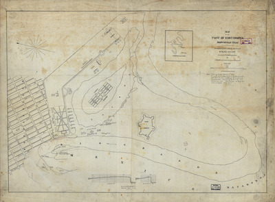
Description
A historical military engineering map detailing the layout of Fort Brown and its immediate surroundings along the Rio Grande bend in Brownsville, Texas. The map illustrates the architectural footprints of the military post facilities, a nearby lagoon, and the adjacent street grid of the town of Brownsville on the left.
Physical Description
.JPG, 1 Page, BW, Scale 1:3000
Preview
Recommended Citation
Haupt, L. M., "Map of the post of Fort Brown, Brownsville, Texas" (1869). Lower Rio Grande Valley Maps. 100.
https://scholarworks.utrgv.edu/maps/100
Keywords
Maps, Texas--Brownsville, Texas--Lower Rio Grande Valley, Mexico--Matamoros, Fort Brown, United States Army, Mexican Army, 1869
