



Lower Rio Grande Valley Maps
Identifier
FactsAboutBrownsville_c1950-A
Creation Date
1950
Description
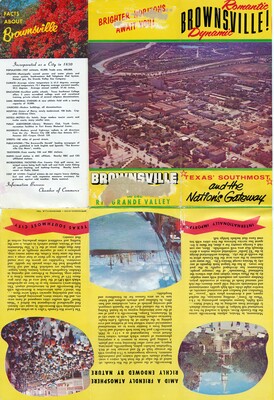
A vintage multi-fold promotional tourist brochure spread displaying promotional illustrations and a complete civic summary directory for Brownsville, Texas. The upper section features a vibrant yellow cover title panel framed by color photographs of the local palm tree lined landscape and the international border bridge crossing. The lower sections present a comprehensive double-sided text guide detailing mid-20th-century municipal infrastructure, climate patterns, regional agricultural industries of the Lower Rio Grande Valley, and the bicultural tourist appeal of neighboring Matamoros, Mexico.
Physical Description
.JPG, 1 Page, Color
Preview
Recommended Citation
"Map of Romantic, Dynamic Brownsville - Page 01 [Brochure]" (1950). Lower Rio Grande Valley Maps. 104.
https://scholarworks.utrgv.edu/maps/104
Keywords
Maps, Texas--Brownsville, Texas--Lower Rio Grande Valley, Mexico--Matamoros, Commercial Maps, 1950s
