



Lower Rio Grande Valley Maps
Creation Date
1933
Description
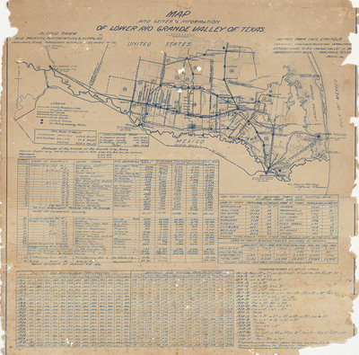
Map includes data for water districts, fruit and vegetable shipping from 1926 to 1932, temperature and precipitation data for 1911-1932, and town and county information including elevations and census information for 1930. "Irrigation, drainage, municipal improvements established in Rio Grande Valley in 190[?]. Irrigation Dist. Bldg. Harlingen, Texas. Phone 130. Alfred Tamm. Blue printing, photostating & supplies". Blue line print. Scale 1" = 6 miles. Date based on last year of recorded statistics.
Physical Description
.JPG, 1 Page, Blue Printing, Scale in miles.
Preview
Recommended Citation
Tamm, Alfred, "Map and general information of Lower Rio Grande Valley of Texas, United States 1932" (1933). Lower Rio Grande Valley Maps. 117.
https://scholarworks.utrgv.edu/maps/117
Keywords
Maps, Lower Rio Grande Valley, Texas, 1911-1932, Statistics, weather
