


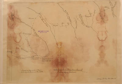
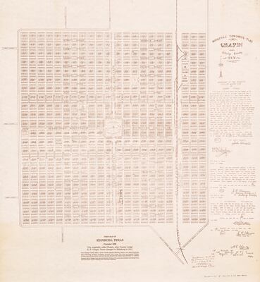
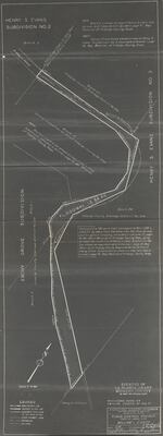
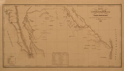
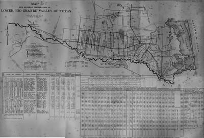
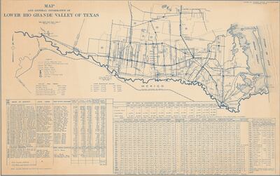
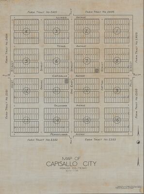
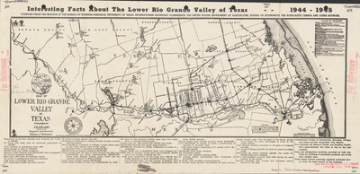
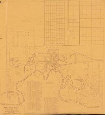
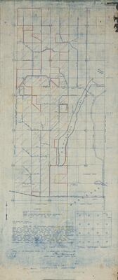
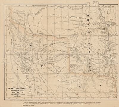
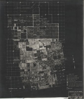
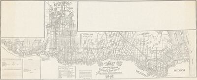
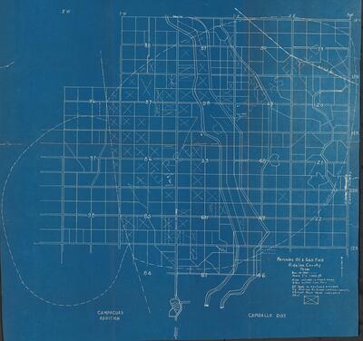
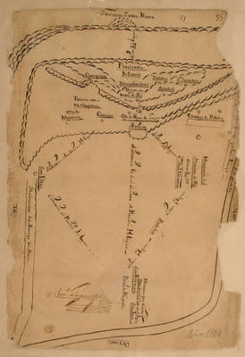
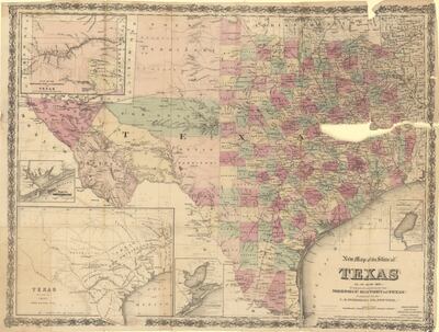
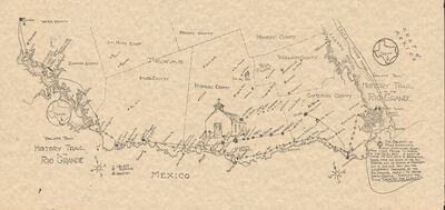
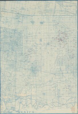
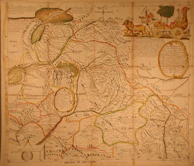
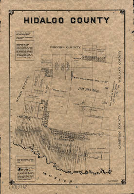
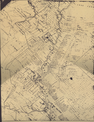
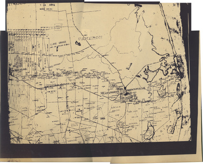
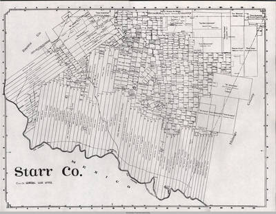
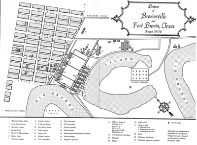
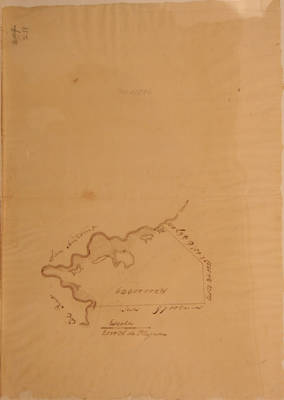
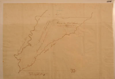
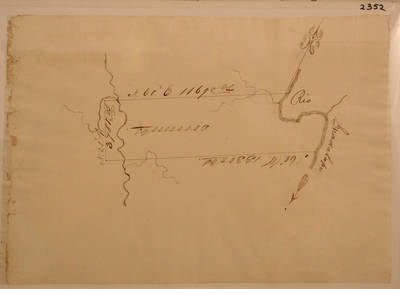
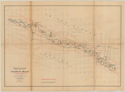
Lower Rio Grande Valley Maps
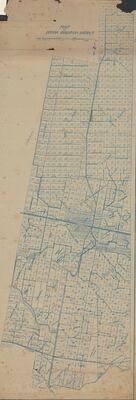
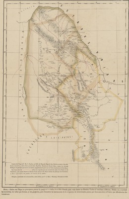
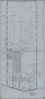
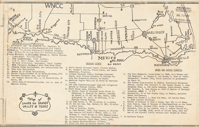
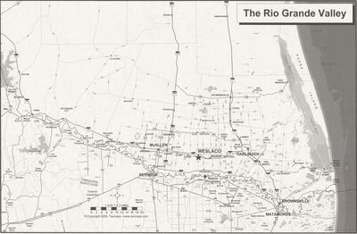
Maps showing the Lower Rio Grande Valley region of South Texas including the counties of Cameron, Hidalgo, Starr and Willacy.
Printing is not supported at the primary Gallery Thumbnail page. Please first navigate to a specific Image before printing.
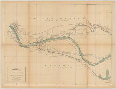
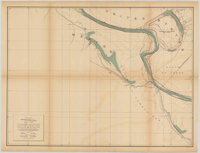
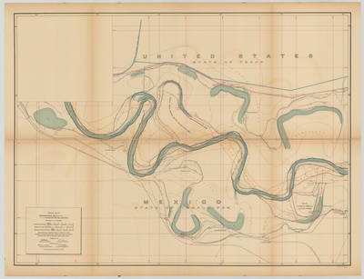
![Topographical Map of the Rio Grande From Roma To The Gulf Of Mexico Sheet No. 13 [Reynosa, Tamaulipas; Hidalgo, Texas] by International Boundary & Water Commission, United States & Mexico.; Julius Bien Co. Photo. Lith.; and Anson Mills](https://scholarworks.utrgv.edu/maps/1028/thumbnail.jpg "Topographical Map of the Rio Grande From Roma To The Gulf Of Mexico Sheet No. 13 [Reynosa, Tamaulipas; Hidalgo, Texas] by International Boundary & Water Commission, United States & Mexico.; Julius Bien Co. Photo. Lith.; and Anson Mills")
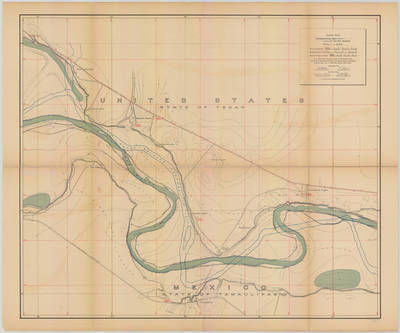
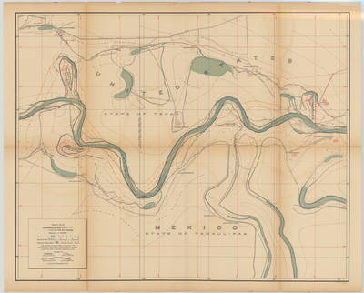
![Topographical Map of the Rio Grande From Roma To The Gulf Of Mexico Sheet No. 14 [Capote Ranch, Texas] by International Boundary & Water Commission, United States & Mexico.; Julius Bien Co. Photo. Lith.; and Anson Mills](https://scholarworks.utrgv.edu/maps/1029/thumbnail.jpg "Topographical Map of the Rio Grande From Roma To The Gulf Of Mexico Sheet No. 14 [Capote Ranch, Texas] by International Boundary & Water Commission, United States & Mexico.; Julius Bien Co. Photo. Lith.; and Anson Mills")
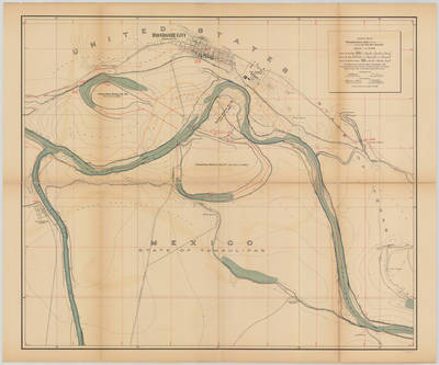
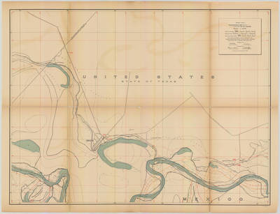
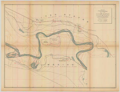
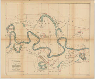
![Topographical Map of the Rio Grande From Roma To The Gulf Of Mexico Sheet No. 15 [San Juan Hacienda, Texas] by International Boundary & Water Commission, United States & Mexico.; Julius Bien Co. Photo. Lith.; and Anson Mills](https://scholarworks.utrgv.edu/maps/1030/thumbnail.jpg "Topographical Map of the Rio Grande From Roma To The Gulf Of Mexico Sheet No. 15 [San Juan Hacienda, Texas] by International Boundary & Water Commission, United States & Mexico.; Julius Bien Co. Photo. Lith.; and Anson Mills")
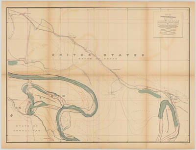
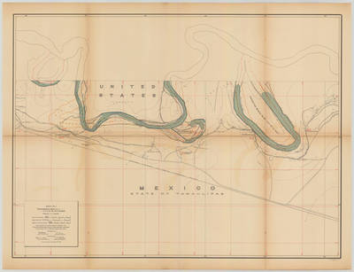
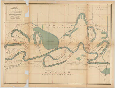
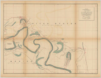
![Topographical Map of the Rio Grande From Roma To The Gulf Of Mexico Sheet No. 16 [Tenacitas Ranch, Tamaulipas] by International Boundary & Water Commission, United States & Mexico.; Julius Bien Co. Photo. Lith.; and Anson Mills](https://scholarworks.utrgv.edu/maps/1031/thumbnail.jpg "Topographical Map of the Rio Grande From Roma To The Gulf Of Mexico Sheet No. 16 [Tenacitas Ranch, Tamaulipas] by International Boundary & Water Commission, United States & Mexico.; Julius Bien Co. Photo. Lith.; and Anson Mills")
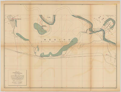
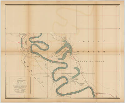
![Topographical Map of the Rio Grande From Roma To The Gulf Of Mexico Sheet No. 17 [San Pedro Ranch and Toluca, Texas] by International Boundary & Water Commission, United States & Mexico.; Julius Bien Co. Photo. Lith.; and Anson Mills](https://scholarworks.utrgv.edu/maps/1032/thumbnail.jpg "Topographical Map of the Rio Grande From Roma To The Gulf Of Mexico Sheet No. 17 [San Pedro Ranch and Toluca, Texas] by International Boundary & Water Commission, United States & Mexico.; Julius Bien Co. Photo. Lith.; and Anson Mills")
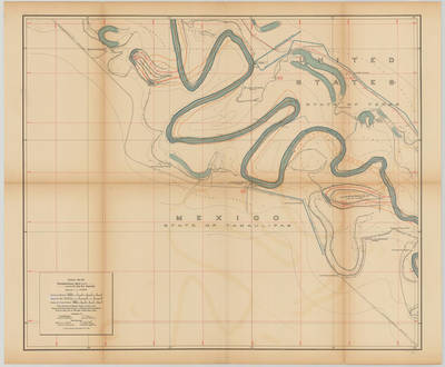
![Topographical Map of the Rio Grande From Roma To The Gulf Of Mexico Sheet No. 18 [Zacatal Ranch, Texas; Mercedes, Texas] by International Boundary & Water Commission, United States & Mexico.; Julius Bien Co. Photo. Lith.; and Anson Mills](https://scholarworks.utrgv.edu/maps/1033/thumbnail.jpg "Topographical Map of the Rio Grande From Roma To The Gulf Of Mexico Sheet No. 18 [Zacatal Ranch, Texas; Mercedes, Texas] by International Boundary & Water Commission, United States & Mexico.; Julius Bien Co. Photo. Lith.; and Anson Mills")
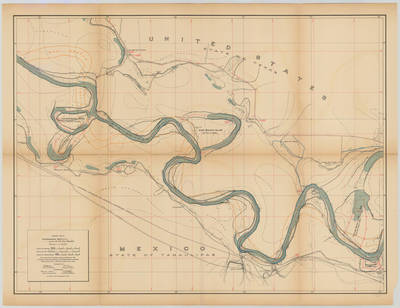
![Topographical Map of the Rio Grande From Roma To The Gulf Of Mexico Sheet No. 19 [Los Indios, La Feria Camp, Texas; Solineno, Tamaulipas] by International Boundary & Water Commission, United States & Mexico.; Julius Bien Co. Photo. Lith.; and Anson Mills](https://scholarworks.utrgv.edu/maps/1034/thumbnail.jpg "Topographical Map of the Rio Grande From Roma To The Gulf Of Mexico Sheet No. 19 [Los Indios, La Feria Camp, Texas; Solineno, Tamaulipas] by International Boundary & Water Commission, United States & Mexico.; Julius Bien Co. Photo. Lith.; and Anson Mills")
![Topographical Map of the Rio Grande From Roma To The Gulf Of Mexico Sheet No. 20 [Los Indios, Carricitos, Landrum, Texas; Escondido Ranch, Texas] by International Boundary & Water Commission, United States & Mexico.; Julius Bien Co. Photo. Lith.; and Anson Mills](https://scholarworks.utrgv.edu/maps/1035/thumbnail.jpg "Topographical Map of the Rio Grande From Roma To The Gulf Of Mexico Sheet No. 20 [Los Indios, Carricitos, Landrum, Texas; Escondido Ranch, Texas] by International Boundary & Water Commission, United States & Mexico.; Julius Bien Co. Photo. Lith.; and Anson Mills")
![Topographical Map of the Rio Grande From Roma To The Gulf Of Mexico Sheet No. 21 [Encantada, Ranchito, El Calaboz, Texas] by International Boundary & Water Commission, United States & Mexico.; Julius Bien Co. Photo. Lith.; and Anson Mills](https://scholarworks.utrgv.edu/maps/1036/thumbnail.jpg "Topographical Map of the Rio Grande From Roma To The Gulf Of Mexico Sheet No. 21 [Encantada, Ranchito, El Calaboz, Texas] by International Boundary & Water Commission, United States & Mexico.; Julius Bien Co. Photo. Lith.; and Anson Mills")
![Topographical Map of the Rio Grande From Roma To The Gulf Of Mexico Sheet No. 22 [San Pedro, Texas; Tahuachal Ranch, Tamaulipas] by International Boundary & Water Commission, United States & Mexico.; Julius Bien Co. Photo. Lith.; and Anson Mills](https://scholarworks.utrgv.edu/maps/1037/thumbnail.jpg "Topographical Map of the Rio Grande From Roma To The Gulf Of Mexico Sheet No. 22 [San Pedro, Texas; Tahuachal Ranch, Tamaulipas] by International Boundary & Water Commission, United States & Mexico.; Julius Bien Co. Photo. Lith.; and Anson Mills")
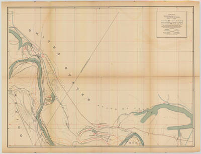
![Topographical Map of the Rio Grande From Roma To The Gulf Of Mexico Sheet No. 23 [Las Rucias, Texas; Cinco de Mayo Ranch, Tamaulipas] by International Boundary & Water Commission, United States & Mexico.; Julius Bien Co. Photo. Lith.; and Anson Mills](https://scholarworks.utrgv.edu/maps/1038/thumbnail.jpg "Topographical Map of the Rio Grande From Roma To The Gulf Of Mexico Sheet No. 23 [Las Rucias, Texas; Cinco de Mayo Ranch, Tamaulipas] by International Boundary & Water Commission, United States & Mexico.; Julius Bien Co. Photo. Lith.; and Anson Mills")
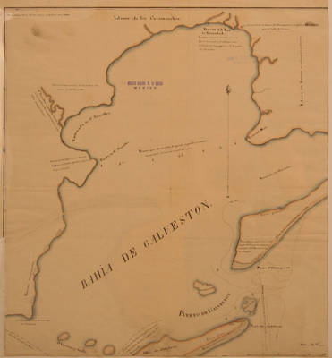
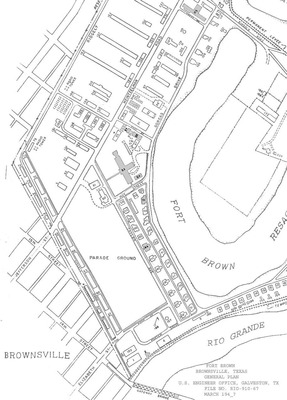
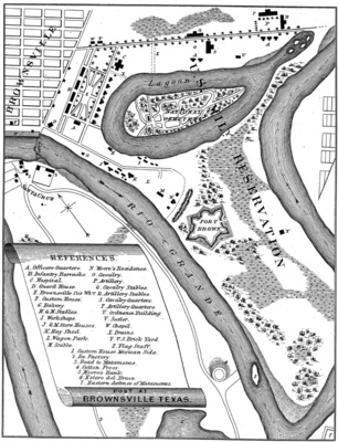
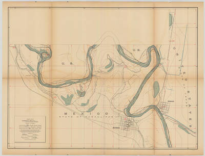
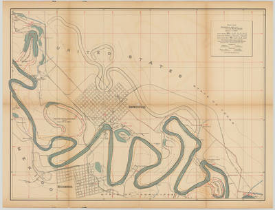
![Topographical Map of the Rio Grande From Roma To The Gulf Of Mexico Sheet No. 24 [Brownsville, Texas] by International Boundary & Water Commission, United States & Mexico.; Julius Bien Co. Photo. Lith.; and Anson Mills](https://scholarworks.utrgv.edu/maps/1039/thumbnail.jpg "Topographical Map of the Rio Grande From Roma To The Gulf Of Mexico Sheet No. 24 [Brownsville, Texas] by International Boundary & Water Commission, United States & Mexico.; Julius Bien Co. Photo. Lith.; and Anson Mills")
![Topographical Map of the Rio Grande From Roma To The Gulf Of Mexico Sheet No. 25 [Southmost, Piper Plantation, Texas] by International Boundary & Water Commission, United States & Mexico.; Julius Bien Co. Photo. Lith.; and Anson Mills](https://scholarworks.utrgv.edu/maps/1040/thumbnail.jpg "Topographical Map of the Rio Grande From Roma To The Gulf Of Mexico Sheet No. 25 [Southmost, Piper Plantation, Texas] by International Boundary & Water Commission, United States & Mexico.; Julius Bien Co. Photo. Lith.; and Anson Mills")
![Topographical Map of the Rio Grande From Roma To The Gulf Of Mexico Sheet No. 26 [Brulay Plantation, San Rafael Ranch, Texas] by International Boundary & Water Commission, United States & Mexico.; Julius Bien Co. Photo. Lith.; and Anson Mills](https://scholarworks.utrgv.edu/maps/1041/thumbnail.jpg "Topographical Map of the Rio Grande From Roma To The Gulf Of Mexico Sheet No. 26 [Brulay Plantation, San Rafael Ranch, Texas] by International Boundary & Water Commission, United States & Mexico.; Julius Bien Co. Photo. Lith.; and Anson Mills")
![Topographical Map of the Rio Grande From Roma To The Gulf Of Mexico Sheet No. 27, [San Martin Ranch, Southmost, Texas] by International Boundary & Water Commission, United States & Mexico.; Julius Bien Co. Photo. Lith.; and Anson Mills](https://scholarworks.utrgv.edu/maps/1042/thumbnail.jpg "Topographical Map of the Rio Grande From Roma To The Gulf Of Mexico Sheet No. 27, [San Martin Ranch, Southmost, Texas] by International Boundary & Water Commission, United States & Mexico.; Julius Bien Co. Photo. Lith.; and Anson Mills")
![Topographical Map of the Rio Grande From Roma To The Gulf Of Mexico Sheet No. 28 [Palmito Ranch, Tulosa Ranch, Port Brownsville (Abandoned), Texas; Arroyo Seco Ranch, Tamaulipas] by International Boundary & Water Commission, United States & Mexico.; Julius Bien Co. Photo. Lith.; and Anson Mills](https://scholarworks.utrgv.edu/maps/1043/thumbnail.jpg "Topographical Map of the Rio Grande From Roma To The Gulf Of Mexico Sheet No. 28 [Palmito Ranch, Tulosa Ranch, Port Brownsville (Abandoned), Texas; Arroyo Seco Ranch, Tamaulipas] by International Boundary & Water Commission, United States & Mexico.; Julius Bien Co. Photo. Lith.; and Anson Mills")
![Topographical Map of the Rio Grande From Roma To The Gulf Of Mexico Sheet No. 29 [{Mouth of Rio Grande}, Ruins of Bagdad, Tamaulipas] by International Boundary & Water Commission, United States & Mexico.; Julius Bien Co. Photo. Lith.; and Anson Mills](https://scholarworks.utrgv.edu/maps/1044/thumbnail.jpg "Topographical Map of the Rio Grande From Roma To The Gulf Of Mexico Sheet No. 29 [{Mouth of Rio Grande}, Ruins of Bagdad, Tamaulipas] by International Boundary & Water Commission, United States & Mexico.; Julius Bien Co. Photo. Lith.; and Anson Mills")
![Topographical Map of the Rio Grande From Roma To The Gulf Of Mexico Sheet No. 30 [Gulf of Mexico] by International Boundary & Water Commission, United States & Mexico.; Julius Bien Co. Photo. Lith.; and Anson Mills](https://scholarworks.utrgv.edu/maps/1045/thumbnail.jpg "Topographical Map of the Rio Grande From Roma To The Gulf Of Mexico Sheet No. 30 [Gulf of Mexico] by International Boundary & Water Commission, United States & Mexico.; Julius Bien Co. Photo. Lith.; and Anson Mills")
