


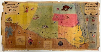
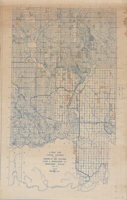
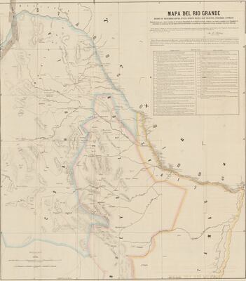
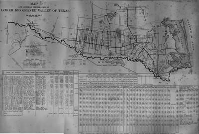
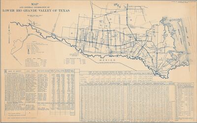
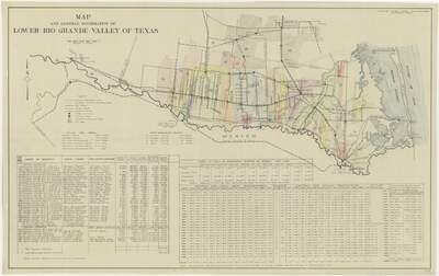
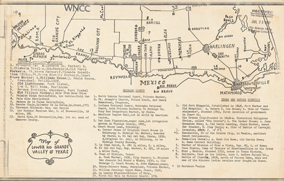
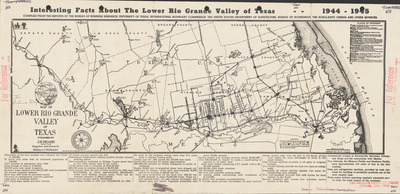
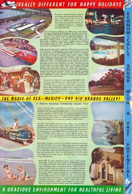
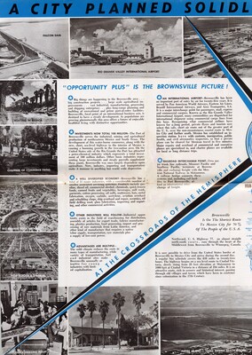
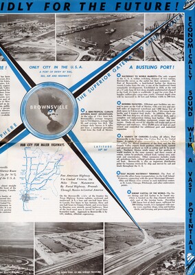
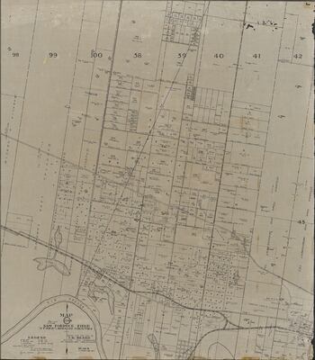
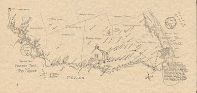
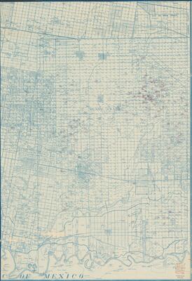
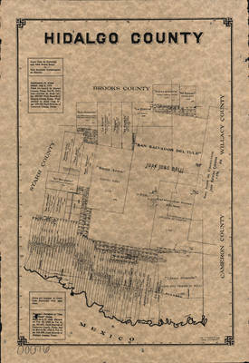
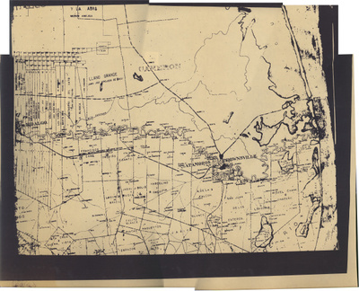
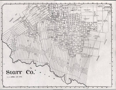
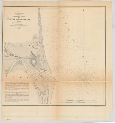
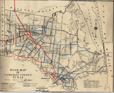
Lower Rio Grande Valley Maps
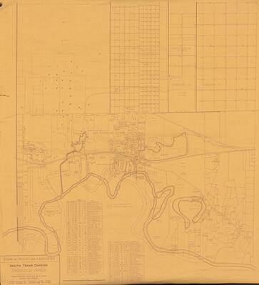
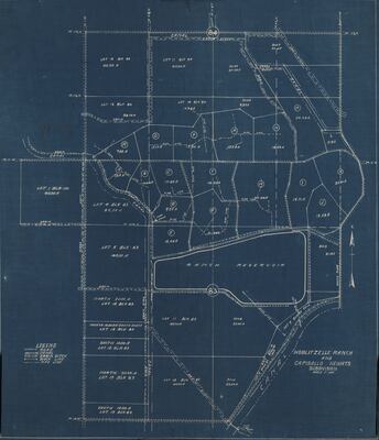
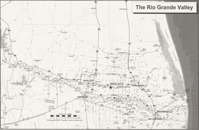
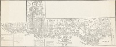
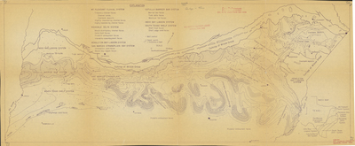
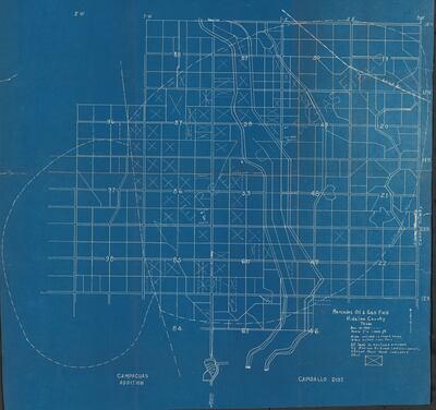
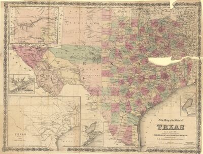
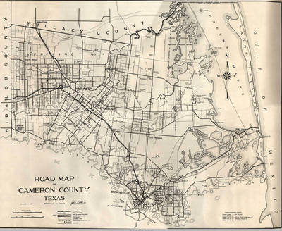
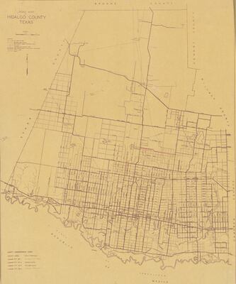
Maps showing the Lower Rio Grande Valley region of South Texas including the counties of Cameron, Hidalgo, Starr, and Willacy.
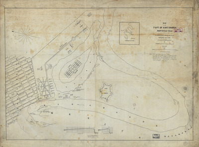
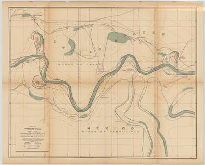
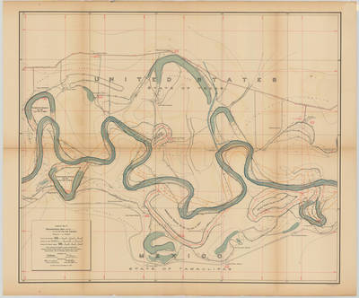
Map collections include International Boundary & Water Commission (IBWC) maps from 1912. Click here to learn more about the IBWC.
Printing is not supported at the primary Gallery Thumbnail page. Please first navigate to a specific Image before printing.
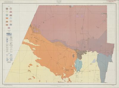
![[Map] Texas Geological Systems by South Texas Geological Society](https://scholarworks.utrgv.edu/maps/1091/thumbnail.jpg "[Map] Texas Geological Systems by South Texas Geological Society")

, 1827-1901. and G.W. & C.B. Colton & Co.")


 by J. C. Harris")
 by George A. Huston")
 by John Huth")
")
")

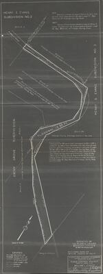
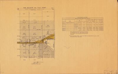
![San Salvador Del Tule Grant : Santa Cruz Ranch Subdivision, Block No. 1 - Part 02 [Detail]](https://scholarworks.utrgv.edu/maps/1059/thumbnail.jpg "San Salvador Del Tule Grant : Santa Cruz Ranch Subdivision, Block No. 1 - Part 02 [Detail]")


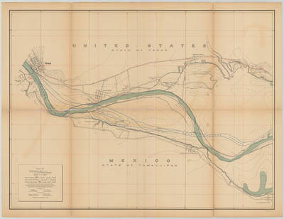
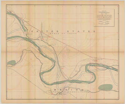
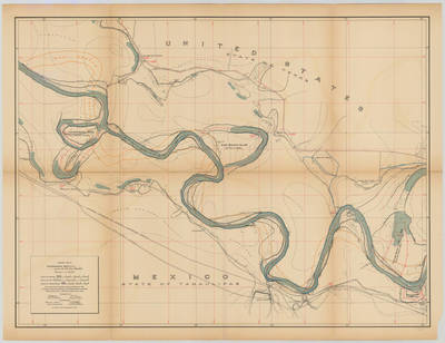
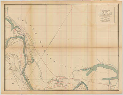
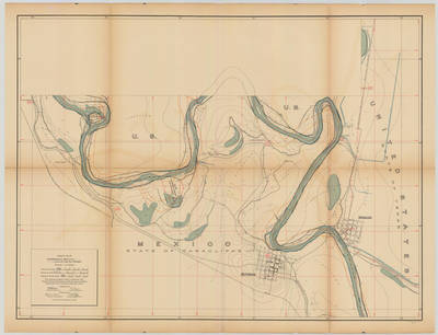
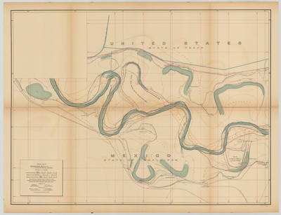
![Topographical Map of the Rio Grande From Roma To The Gulf Of Mexico Sheet No. 01 [Roma and Saenz Ranch, Texas; Guardado de Arriba Ranch, Tamaulipas] by International Boundary & Water Commission, United States & Mexico.; Julius Bien Co. Photo. Lith.; and Anson Mills](https://scholarworks.utrgv.edu/maps/1016/thumbnail.jpg "Topographical Map of the Rio Grande From Roma To The Gulf Of Mexico Sheet No. 01 [Roma and Saenz Ranch, Texas; Guardado de Arriba Ranch, Tamaulipas] by International Boundary & Water Commission, United States & Mexico.; Julius Bien Co. Photo. Lith.; and Anson Mills")
![Topographical Map of the Rio Grande From Roma To The Gulf Of Mexico Sheet No. 02 [Villarreales Ranch, Texas] by International Boundary & Water Commission, United States & Mexico.; Julius Bien Co. Photo. Lith.; and Anson Mills](https://scholarworks.utrgv.edu/maps/1017/thumbnail.jpg "Topographical Map of the Rio Grande From Roma To The Gulf Of Mexico Sheet No. 02 [Villarreales Ranch, Texas] by International Boundary & Water Commission, United States & Mexico.; Julius Bien Co. Photo. Lith.; and Anson Mills")
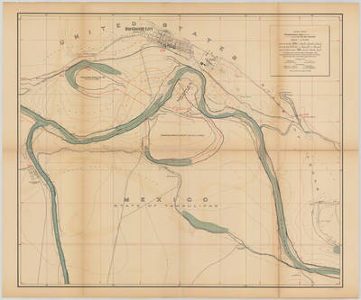
![Topographical Map of the Rio Grande From Roma To The Gulf Of Mexico Sheet No. 03 [Rio Grande City, Texas] by International Boundary & Water Commission, United States & Mexico.; Julius Bien Co. Photo. Lith.; and Anson Mills](https://scholarworks.utrgv.edu/maps/1018/thumbnail.jpg "Topographical Map of the Rio Grande From Roma To The Gulf Of Mexico Sheet No. 03 [Rio Grande City, Texas] by International Boundary & Water Commission, United States & Mexico.; Julius Bien Co. Photo. Lith.; and Anson Mills")
![Topographical Map of the Rio Grande From Roma To The Gulf Of Mexico Sheet No. 04 [Garcia Ranch, Texas] by International Boundary & Water Commission, United States & Mexico.; Julius Bien Co. Photo. Lith.; and Anson Mills](https://scholarworks.utrgv.edu/maps/1019/thumbnail.jpg "Topographical Map of the Rio Grande From Roma To The Gulf Of Mexico Sheet No. 04 [Garcia Ranch, Texas] by International Boundary & Water Commission, United States & Mexico.; Julius Bien Co. Photo. Lith.; and Anson Mills")
![Topographical Map of the Rio Grande From Roma To The Gulf Of Mexico Sheet No. 05 [San Francisco Ranch, Tamaulipas] by International Boundary & Water Commission, United States & Mexico.; Julius Bien Co. Photo. Lith.; and Anson Mills](https://scholarworks.utrgv.edu/maps/1020/thumbnail.jpg "Topographical Map of the Rio Grande From Roma To The Gulf Of Mexico Sheet No. 05 [San Francisco Ranch, Tamaulipas] by International Boundary & Water Commission, United States & Mexico.; Julius Bien Co. Photo. Lith.; and Anson Mills")
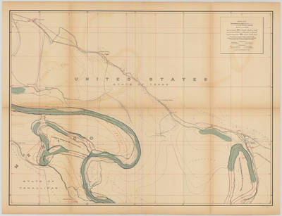
![Topographical Map of the Rio Grande From Roma To The Gulf Of Mexico Sheet No. 06 [Grulla, Texas] by International Boundary & Water Commission, United States & Mexico.; Julius Bien Co. Photo. Lith.; and Anson Mills](https://scholarworks.utrgv.edu/maps/1021/thumbnail.jpg "Topographical Map of the Rio Grande From Roma To The Gulf Of Mexico Sheet No. 06 [Grulla, Texas] by International Boundary & Water Commission, United States & Mexico.; Julius Bien Co. Photo. Lith.; and Anson Mills")
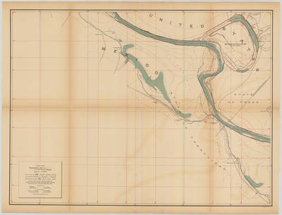
![Topographical Map of the Rio Grande From Roma To The Gulf Of Mexico Sheet No. 07 [Valadeces, Tamaulipas] by International Boundary & Water Commission, United States & Mexico.; Julius Bien Co. Photo. Lith.; and Anson Mills](https://scholarworks.utrgv.edu/maps/1022/thumbnail.jpg "Topographical Map of the Rio Grande From Roma To The Gulf Of Mexico Sheet No. 07 [Valadeces, Tamaulipas] by International Boundary & Water Commission, United States & Mexico.; Julius Bien Co. Photo. Lith.; and Anson Mills")
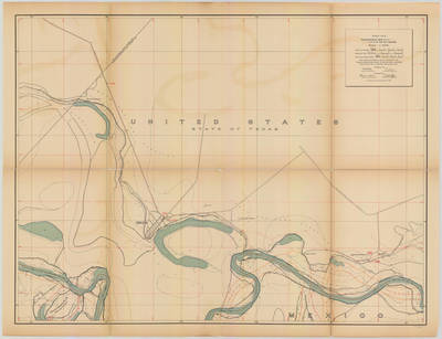
![Topographical Map of the Rio Grande From Roma To The Gulf Of Mexico Sheet No. 08 [Los Ebanos, Sullivan City, Sam Fordyce, Texas] by International Boundary & Water Commission, United States & Mexico.; Julius Bien Co. Photo. Lith.; and Anson Mills](https://scholarworks.utrgv.edu/maps/1023/thumbnail.jpg "Topographical Map of the Rio Grande From Roma To The Gulf Of Mexico Sheet No. 08 [Los Ebanos, Sullivan City, Sam Fordyce, Texas] by International Boundary & Water Commission, United States & Mexico.; Julius Bien Co. Photo. Lith.; and Anson Mills")
![Topographical Map of the Rio Grande From Roma To The Gulf Of Mexico Sheet No. 09 [Diaz Ordaz, Tamaulipas] by International Boundary & Water Commission, United States & Mexico.; Julius Bien Co. Photo. Lith.; and Anson Mills](https://scholarworks.utrgv.edu/maps/1024/thumbnail.jpg "Topographical Map of the Rio Grande From Roma To The Gulf Of Mexico Sheet No. 09 [Diaz Ordaz, Tamaulipas] by International Boundary & Water Commission, United States & Mexico.; Julius Bien Co. Photo. Lith.; and Anson Mills")
![Topographical Map of the Rio Grande From Roma To The Gulf Of Mexico Sheet No. 10 [Reynosa Viejo, Tamaulipas; Penitas, Texas] by International Boundary & Water Commission, United States & Mexico.; Julius Bien Co. Photo. Lith.; and Anson Mills](https://scholarworks.utrgv.edu/maps/1025/thumbnail.jpg "Topographical Map of the Rio Grande From Roma To The Gulf Of Mexico Sheet No. 10 [Reynosa Viejo, Tamaulipas; Penitas, Texas] by International Boundary & Water Commission, United States & Mexico.; Julius Bien Co. Photo. Lith.; and Anson Mills")
![Topographical Map of the Rio Grande From Roma To The Gulf Of Mexico Sheet No. 11 [Ojo de Agua Ranch, Texas; Los Fresnos Ranch, Tamaulipas] by International Boundary & Water Commission, United States & Mexico.; Julius Bien Co. Photo. Lith.; and Anson Mills](https://scholarworks.utrgv.edu/maps/1026/thumbnail.jpg "Topographical Map of the Rio Grande From Roma To The Gulf Of Mexico Sheet No. 11 [Ojo de Agua Ranch, Texas; Los Fresnos Ranch, Tamaulipas] by International Boundary & Water Commission, United States & Mexico.; Julius Bien Co. Photo. Lith.; and Anson Mills")
![Topographical Map of the Rio Grande From Roma To The Gulf Of Mexico Sheet No. 12 [Lomitas Ranch, Texas] by International Boundary & Water Commission, United States & Mexico.; Julius Bien Co. Photo. Lith.; and Anson Mills](https://scholarworks.utrgv.edu/maps/1027/thumbnail.jpg "Topographical Map of the Rio Grande From Roma To The Gulf Of Mexico Sheet No. 12 [Lomitas Ranch, Texas] by International Boundary & Water Commission, United States & Mexico.; Julius Bien Co. Photo. Lith.; and Anson Mills")
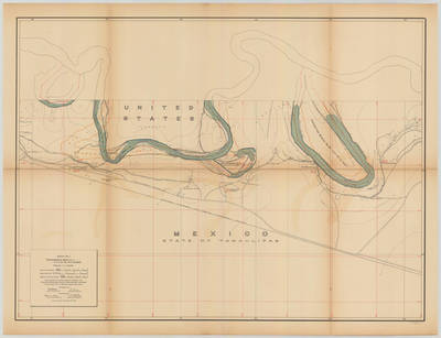
![Topographical Map of the Rio Grande From Roma To The Gulf Of Mexico Sheet No. 13 [Reynosa, Tamaulipas; Hidalgo, Texas] by International Boundary & Water Commission, United States & Mexico.; Julius Bien Co. Photo. Lith.; and Anson Mills](https://scholarworks.utrgv.edu/maps/1028/thumbnail.jpg "Topographical Map of the Rio Grande From Roma To The Gulf Of Mexico Sheet No. 13 [Reynosa, Tamaulipas; Hidalgo, Texas] by International Boundary & Water Commission, United States & Mexico.; Julius Bien Co. Photo. Lith.; and Anson Mills")
![Topographical Map of the Rio Grande From Roma To The Gulf Of Mexico Sheet No. 14 [Capote Ranch, Texas] by International Boundary & Water Commission, United States & Mexico.; Julius Bien Co. Photo. Lith.; and Anson Mills](https://scholarworks.utrgv.edu/maps/1029/thumbnail.jpg "Topographical Map of the Rio Grande From Roma To The Gulf Of Mexico Sheet No. 14 [Capote Ranch, Texas] by International Boundary & Water Commission, United States & Mexico.; Julius Bien Co. Photo. Lith.; and Anson Mills")
![Topographical Map of the Rio Grande From Roma To The Gulf Of Mexico Sheet No. 15 [San Juan Hacienda, Texas] by International Boundary & Water Commission, United States & Mexico.; Julius Bien Co. Photo. Lith.; and Anson Mills](https://scholarworks.utrgv.edu/maps/1030/thumbnail.jpg "Topographical Map of the Rio Grande From Roma To The Gulf Of Mexico Sheet No. 15 [San Juan Hacienda, Texas] by International Boundary & Water Commission, United States & Mexico.; Julius Bien Co. Photo. Lith.; and Anson Mills")
![Topographical Map of the Rio Grande From Roma To The Gulf Of Mexico Sheet No. 16 [Tenacitas Ranch, Tamaulipas] by International Boundary & Water Commission, United States & Mexico.; Julius Bien Co. Photo. Lith.; and Anson Mills](https://scholarworks.utrgv.edu/maps/1031/thumbnail.jpg "Topographical Map of the Rio Grande From Roma To The Gulf Of Mexico Sheet No. 16 [Tenacitas Ranch, Tamaulipas] by International Boundary & Water Commission, United States & Mexico.; Julius Bien Co. Photo. Lith.; and Anson Mills")
![Topographical Map of the Rio Grande From Roma To The Gulf Of Mexico Sheet No. 17 [San Pedro Ranch and Toluca, Texas] by International Boundary & Water Commission, United States & Mexico.; Julius Bien Co. Photo. Lith.; and Anson Mills](https://scholarworks.utrgv.edu/maps/1032/thumbnail.jpg "Topographical Map of the Rio Grande From Roma To The Gulf Of Mexico Sheet No. 17 [San Pedro Ranch and Toluca, Texas] by International Boundary & Water Commission, United States & Mexico.; Julius Bien Co. Photo. Lith.; and Anson Mills")
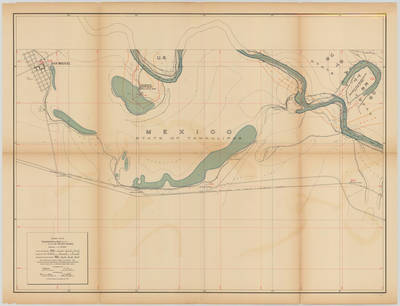
![Topographical Map of the Rio Grande From Roma To The Gulf Of Mexico Sheet No. 18 [Zacatal Ranch, Texas; Mercedes, Texas] by International Boundary & Water Commission, United States & Mexico.; Julius Bien Co. Photo. Lith.; and Anson Mills](https://scholarworks.utrgv.edu/maps/1033/thumbnail.jpg "Topographical Map of the Rio Grande From Roma To The Gulf Of Mexico Sheet No. 18 [Zacatal Ranch, Texas; Mercedes, Texas] by International Boundary & Water Commission, United States & Mexico.; Julius Bien Co. Photo. Lith.; and Anson Mills")
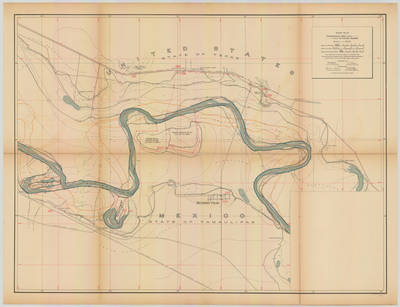
![Topographical Map of the Rio Grande From Roma To The Gulf Of Mexico Sheet No. 19 [Los Indios, La Feria Camp, Texas; Solineno, Tamaulipas] by International Boundary & Water Commission, United States & Mexico.; Julius Bien Co. Photo. Lith.; and Anson Mills](https://scholarworks.utrgv.edu/maps/1034/thumbnail.jpg "Topographical Map of the Rio Grande From Roma To The Gulf Of Mexico Sheet No. 19 [Los Indios, La Feria Camp, Texas; Solineno, Tamaulipas] by International Boundary & Water Commission, United States & Mexico.; Julius Bien Co. Photo. Lith.; and Anson Mills")
![Topographical Map of the Rio Grande From Roma To The Gulf Of Mexico Sheet No. 20 [Los Indios, Carricitos, Landrum, Texas; Escondido Ranch, Texas] by International Boundary & Water Commission, United States & Mexico.; Julius Bien Co. Photo. Lith.; and Anson Mills](https://scholarworks.utrgv.edu/maps/1035/thumbnail.jpg "Topographical Map of the Rio Grande From Roma To The Gulf Of Mexico Sheet No. 20 [Los Indios, Carricitos, Landrum, Texas; Escondido Ranch, Texas] by International Boundary & Water Commission, United States & Mexico.; Julius Bien Co. Photo. Lith.; and Anson Mills")
![Topographical Map of the Rio Grande From Roma To The Gulf Of Mexico Sheet No. 21 [Encantada, Ranchito, El Calaboz, Texas] by International Boundary & Water Commission, United States & Mexico.; Julius Bien Co. Photo. Lith.; and Anson Mills](https://scholarworks.utrgv.edu/maps/1036/thumbnail.jpg "Topographical Map of the Rio Grande From Roma To The Gulf Of Mexico Sheet No. 21 [Encantada, Ranchito, El Calaboz, Texas] by International Boundary & Water Commission, United States & Mexico.; Julius Bien Co. Photo. Lith.; and Anson Mills")
![Topographical Map of the Rio Grande From Roma To The Gulf Of Mexico Sheet No. 22 [San Pedro, Texas; Tahuachal Ranch, Tamaulipas] by International Boundary & Water Commission, United States & Mexico.; Julius Bien Co. Photo. Lith.; and Anson Mills](https://scholarworks.utrgv.edu/maps/1037/thumbnail.jpg "Topographical Map of the Rio Grande From Roma To The Gulf Of Mexico Sheet No. 22 [San Pedro, Texas; Tahuachal Ranch, Tamaulipas] by International Boundary & Water Commission, United States & Mexico.; Julius Bien Co. Photo. Lith.; and Anson Mills")
![Topographical Map of the Rio Grande From Roma To The Gulf Of Mexico Sheet No. 23 [Las Rucias, Texas; Cinco de Mayo Ranch, Tamaulipas] by International Boundary & Water Commission, United States & Mexico.; Julius Bien Co. Photo. Lith.; and Anson Mills](https://scholarworks.utrgv.edu/maps/1038/thumbnail.jpg "Topographical Map of the Rio Grande From Roma To The Gulf Of Mexico Sheet No. 23 [Las Rucias, Texas; Cinco de Mayo Ranch, Tamaulipas] by International Boundary & Water Commission, United States & Mexico.; Julius Bien Co. Photo. Lith.; and Anson Mills")
![Topographical Map of the Rio Grande From Roma To The Gulf Of Mexico Sheet No. 24 [Brownsville, Texas] by International Boundary & Water Commission, United States & Mexico.; Julius Bien Co. Photo. Lith.; and Anson Mills](https://scholarworks.utrgv.edu/maps/1039/thumbnail.jpg "Topographical Map of the Rio Grande From Roma To The Gulf Of Mexico Sheet No. 24 [Brownsville, Texas] by International Boundary & Water Commission, United States & Mexico.; Julius Bien Co. Photo. Lith.; and Anson Mills")
![Topographical Map of the Rio Grande From Roma To The Gulf Of Mexico Sheet No. 25 [Southmost, Piper Plantation, Texas] by International Boundary & Water Commission, United States & Mexico.; Julius Bien Co. Photo. Lith.; and Anson Mills](https://scholarworks.utrgv.edu/maps/1040/thumbnail.jpg "Topographical Map of the Rio Grande From Roma To The Gulf Of Mexico Sheet No. 25 [Southmost, Piper Plantation, Texas] by International Boundary & Water Commission, United States & Mexico.; Julius Bien Co. Photo. Lith.; and Anson Mills")
![Topographical Map of the Rio Grande From Roma To The Gulf Of Mexico Sheet No. 26 [Brulay Plantation, San Rafael Ranch, Texas] by International Boundary & Water Commission, United States & Mexico.; Julius Bien Co. Photo. Lith.; and Anson Mills](https://scholarworks.utrgv.edu/maps/1041/thumbnail.jpg "Topographical Map of the Rio Grande From Roma To The Gulf Of Mexico Sheet No. 26 [Brulay Plantation, San Rafael Ranch, Texas] by International Boundary & Water Commission, United States & Mexico.; Julius Bien Co. Photo. Lith.; and Anson Mills")
![Topographical Map of the Rio Grande From Roma To The Gulf Of Mexico Sheet No. 27, [San Martin Ranch, Southmost, Texas] by International Boundary & Water Commission, United States & Mexico.; Julius Bien Co. Photo. Lith.; and Anson Mills](https://scholarworks.utrgv.edu/maps/1042/thumbnail.jpg "Topographical Map of the Rio Grande From Roma To The Gulf Of Mexico Sheet No. 27, [San Martin Ranch, Southmost, Texas] by International Boundary & Water Commission, United States & Mexico.; Julius Bien Co. Photo. Lith.; and Anson Mills")
![Topographical Map of the Rio Grande From Roma To The Gulf Of Mexico Sheet No. 28 [Palmito Ranch, Tulosa Ranch, Port Brownsville (Abandoned), Texas; Arroyo Seco Ranch, Tamaulipas] by International Boundary & Water Commission, United States & Mexico.; Julius Bien Co. Photo. Lith.; and Anson Mills](https://scholarworks.utrgv.edu/maps/1043/thumbnail.jpg "Topographical Map of the Rio Grande From Roma To The Gulf Of Mexico Sheet No. 28 [Palmito Ranch, Tulosa Ranch, Port Brownsville (Abandoned), Texas; Arroyo Seco Ranch, Tamaulipas] by International Boundary & Water Commission, United States & Mexico.; Julius Bien Co. Photo. Lith.; and Anson Mills")
![Topographical Map of the Rio Grande From Roma To The Gulf Of Mexico Sheet No. 29 [{Mouth of Rio Grande}, Ruins of Bagdad, Tamaulipas] by International Boundary & Water Commission, United States & Mexico.; Julius Bien Co. Photo. Lith.; and Anson Mills](https://scholarworks.utrgv.edu/maps/1044/thumbnail.jpg "Topographical Map of the Rio Grande From Roma To The Gulf Of Mexico Sheet No. 29 [{Mouth of Rio Grande}, Ruins of Bagdad, Tamaulipas] by International Boundary & Water Commission, United States & Mexico.; Julius Bien Co. Photo. Lith.; and Anson Mills")
![Topographical Map of the Rio Grande From Roma To The Gulf Of Mexico Sheet No. 30 [Gulf of Mexico] by International Boundary & Water Commission, United States & Mexico.; Julius Bien Co. Photo. Lith.; and Anson Mills](https://scholarworks.utrgv.edu/maps/1045/thumbnail.jpg "Topographical Map of the Rio Grande From Roma To The Gulf Of Mexico Sheet No. 30 [Gulf of Mexico] by International Boundary & Water Commission, United States & Mexico.; Julius Bien Co. Photo. Lith.; and Anson Mills")
